Public or private recreational and leisure areas
Read MoreOn this page you can learn more about Environmental Regularization and Limit Respectability processes. Also check out our Land Management Leaflet.
See Land Management LeafletWhat can or should be regularized?
Access to water for housing development areas and leisure houses around the reservoir
Read MoreWater access for hotels, inns and clubs surrounding the reservoir
Read MoreUses of reservoir water for agricultural and livestock activities
Read MoreAquaculture areas and parks (fish farming in net-cages)
Read MoreCapture and use of water for various uses
Read MoreEmission of effluents in the reservoir
Read MoreFerry transportation and its berths
Read MoreMineral extraction
Read More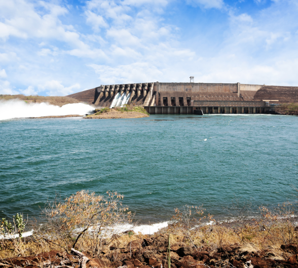
What is allowed in regularized areas?
The reservoir of the São Simão Hydropower Plant can be used in several ways. However, all activities must follow a standard to respect people’s safety, the environment, and the laws. In total, 8 activities are permitted in environmental regularization areas, provided they are in accordance with the legislation.
What can’t be regularized?
Environmental regularization in Permanent Protection Area (Área de Proteção Permanente, APP) is based on current legislation. Thus, it is understood that uses or occupations that cause significant impact on the environment, that are not intended for public utility or that do not meet the collective social interest are not permitted.
What is allowed in regularized areas?
-
Establishing public or private recreation and leisure areas
-
Collect water for human or animal consumption, irrigation, or industrial use
-
Building piers or wharfs and boat ramps
-
Raising fish in net cages
-
Maintaining floating structures for recreation or leisure
-
Mining clay, sand and gravel
-
Maintaining floating structures to support productive activity, such as water capture or maintenance of net cages
-
Transporting cargo and passengers on ferries
Understand what is allowed as long as it is regularized:
-
Suppressing existing vegetation
-
Making campfires or handling machinery or objects that may start wildfires
-
Using the area to compost organic waste
-
Washing agricultural defensive tanks
-
Building improvements of private interest, such as houses, kiosks, stalls, platforms, sumps, bathrooms, stables, pigsties (raising pigs) and hens (raising birds), animal feed storage
-
Transiting with vehicles and motorcycles
-
Handling chemicals, fuels, or spilling fuel oils and lubricants
-
Using the area for perennial agricultural crops and diverse livestock-raising such as cattle, horses and sheep
How to regularize a use or occupancy that is current or on the way to being implemented?
The process of regularizing a use or occupancy in a concession area of the UHE São Simão is very simple. See the step-by-step guide:

Request from Stakeholder
The stakeholder requests UHESS consent (agreement) to seek environmental regularization of occupation or desired use in a concession area (bank or shoreline). This request can be made through the contacts available on the last page of the Land Management Leaflet, where the requester reports the occupant’s or stakeholder’s data, the location and type of use or occupation to be implemented or regularized. The UHESS will forward to the stakeholder the list of documents necessary to regularize the desired use or occupation.

UHESS assessment
Upon receiving the documentation, the São Simão Hydropower Plant will evaluate it and conduct an on-site inspection. If everything is in order, the UHESS issues a Prior Consent Letter to the stakeholder to seek appropriate environmental licensing of the desired use or occupation. In case of questions or identification of incomplete documentation, the UHESS will contact the stakeholder and ask for a supplement to the information. When answering questions or receiving the rest of the documentation, the UHESS will issue the Prior Consent Letter to the stakeholder, so that it seeks the appropriate environmental licensing of the desired use or occupation.

Request from Stakeholder
The stakeholder requests UHESS consent (agreement) to seek environmental regularization of occupation or desired use in a concession area (bank or shoreline). This request can be made through the contacts available on the last page of the Land Management Leaflet, where the requester reports the occupant’s or stakeholder’s data, the location and type of use or occupation to be implemented or regularized. The UHESS will forward to the stakeholder the list of documents necessary to regularize the desired use or occupation.

Regularization of use or occupancy
In possession of the Prior Consent Letter, the stakeholder seeks the necessary licenses from the environmental and competent bodies. The letter of consent indicates to these institutions that there are no objections on the part of the UHESS to the licensing of the requested use in a company concession area.

Licenses issued and contract
With the licenses and authorizations obtained, the stakeholder again contacts the São Simão Hydropower Plant to sign an assignment contract for use and non-onerous occupation. This contract guarantees the stakeholder the use and occupation of the claimed site during the concession period of the plant.
Frequently Asked Questions
-
Why is the UHESS required to inspect the reservoir and its banks and what are the laws and regulations we must respect?
The UHE São Simão reservoir enables various uses in addition to storing water for the purposes of generating electric power. However, each of the multiple uses of the reservoir is regulated in specific law(s). The correct use and occupancy of the reservoir and its banks seek to maintain the good environmental quality of its waters and its surroundings, providing the most diverse activities.
The UHESS Concession Contract establishes that UHE São Simão Energia S.A. is responsible for the operation and maintenance of the hydropower plant, for the management of the correct use and occupation of the reservoir and other areas belonging to the concession, in accordance with the relevant legislation and regulations.
Thus, the UHESS is responsible for ensuring the integrity of the reservoir and the strip of land that surrounds it up to the elevation of 402 m, called the expropriation elevation. The maximum normal level of operation of the reservoir is the elevation 401.0 m. The strip of land between these elevations is called the safety strip.
The safety strip is located in the Permanent Preservation Area (APP) of the UHESS reservoir. The APP is a legally protected and restricted-use strip of land, as it has an environmental function to preserve water resources, landscape, geological stability and biodiversity; facilitate the gene flow of fauna and flora; protect the soil and ensure the well-being of human populations.
APPs play an important role in maintaining the environment and promoting the quality of life of society, fauna and flora, provided they are duly respected and preserved.
-
How is the Permanent Preservation Area of the UHE São Simão reservoir defined?
In the UHESS, the definition of the APP is provided by Law No. 12.651/12, art. 62. According to the definition of this Law, the APP of this reservoir is the strip of land between the maximum normal operating elevations (401 m) and the maximum elevation of all maximums (401.8 m).
Because it is a protected area, and of restricted use, only those uses and occupations that are classified as of public utility, social interest or low environmental impact are permitted. Thus, the UHE São Simão always seeks environmental compliance and, whenever possible and permitted by law, the regularization of existing uses and occupations in the reservoir and its surroundings. For these reasons, the areas that are part of the concession area and the reservoir are subject to continuous inspection and monitoring by the company.
Learn More
Safety Strip: is the strip of land between the normal maximum operating elevation and the expropriation elevation. Its use is restricted, as it may eventually be flooded, bringing risks to occupants. The APP is located within it.
Permanent Preservation Area (APP): strip of land protected by Law and of restricted use and occupation. It corresponds to the area between the maximum official quota for operation and the utmost maximum quota.
-
Why should I regularize a use or occupation in the UHE São Simão concession area?
The regularization of uses and occupations in areas under concession of the UHE São Simão aims at the safety of people, maintenance of the environmental quality of the reservoir and its surroundings, promoting the multiple and sustainable use of the reservoir and its surroundings.
By complying with environmental legislation, the environment, biodiversity, water quality and regional landscape are preserved.
In addition, with environmental regularization with the competent environmental agencies, UHE São Simão may sign a non-onerous cession of use and occupation contract of the area used for a long period of time with the occupant.
-
What are the main uses or occupations that can be regularized?
In the concession area of the UHE São Simão, the main uses or occupations subject to regularization on the banks of the reservoir are public or private recreation and leisure areas, piers and boat ramps, water capture for irrigation, ferry mooring points, locations for passage of piping that transports materials mined in the reservoir.
Uses and occupations in the reservoir’s shoreline, such as floats used for recreation and leisure, aquaculture parks with network tanks, sand mining areas, ferry crossings, floating water capture also need to be regularized.
-
What is a Concession?
Concession is the permission given by the State for any public service to a private company. In the case of the UHE São Simão, the company acquired, in a public tender, the right to operate, maintain and sell the energy generated at the hydropower plant for a period of 30 years.
Thus, the UHESS is responsible for ensuring the integrity of the reservoir and the strip of land that surrounds it up to the elevation of 402 m, called the expropriation elevation. The maximum normal level of operation of the reservoir is the elevation 401.0 m. The strip of land between these elevations is called the safety strip.
-
How to identify the 402 m elevation in the field?
The 402 m elevation defines the limit of the UHESS Concession area. It corresponds to an altitude in relation to the average sea level (orthometric altitude) and is defined through topographical and geodetic surveys.
The IBGE (Instituto Brasileiro de Geografia e Estatística [Brazilian Institute of Geography and Statistics]) provides the Altimetric Network, which consists of a set of geodetic stations, called level references, that materialize the altimetric component of the Brazilian Geodetic System (Sistema Geodésico Brasileiro, SGB) from high precision geometric leveling measurements. All topographical/geodetic surveys must be referred to the SGB.
-
How to regularize new interventions on the bank of the reservoir?
Because they are located in a Permanent Preservation Area (APP) of the reservoir, improvements, such as ramps for boats, fences, ecological trails, wharfs for boats or for fishing, kiosks and lighting poles, may be established, provided they are licensed by the competent environmental agency.
When thinking about a use and occupation on the edge of the reservoir or its shoreline, in addition to obeying the legislation, check the best materials and constructive forms, in order to minimize the impact of the use or occupation. The integration of the landscape into the reservoir, the maintenance of native vegetation and the good quality of the water attract wildlife species, in addition to valuing their occupation and surroundings.
Housing developments and condominiums near the reservoir should seek to optimize the structures and improvements in the APP strip to avoid accumulation of environmental impacts. In these projects, it is suggested that they establish collective accesses to the reservoir, green areas that provide the sustainability of the APP and improvements that do not impact the reservoir, as well as its surroundings.
The environmental licensing body and the UHE São Simão can assist in the guidance and licensing of uses and occupation of the reservoir and its surroundings, in order to preserve the aquatic and terrestrial environments.
Because use and occupancy in APPs are regulated and restricted, only the responsible environmental licensing body may permit and authorize the desired intervention at this location. Therefore, consult the licensing body before performing any intervention, to find out if it is permissible, and the UHE São Simão, to find out if the use or occupation are permitted by the company in the desired location. Remember: any intervention in the shoreline of the reservoir must be authorized by the Brazilian Navy.
What procedures will the Confronting Party perform?
The approval process for Limit Respectability is very simple. See the step-by-step guide:
-
1. Letter of Consent
The final printed documents signed by the Intervening Consenting Party and the UHESS Letter of Consent will be forwarded to the stakeholder and the process is completed.
-
2. Stakeholder Request (Confronting Party)
The stakeholder requests the UHE São Simão’s consent (agreement) for Respectability of Limits. This request can be made through the contacts available on the website.
The stakeholder may send the documents for the Preliminary Analysis at the first contact.
At this stage, all documents must be forwarded digitally, they are:
- Updated registration or transcription of the property (term less than one year);
- Cartographic Material:
- Georeferenced property limits (format shapefile) specifying the SIRGAS 2000 geodetic DATUM;
- Georeferenced plant certified by INCRA (for properties greater than 100 hectares);
- ART - [Anotação de Responsabilidade Técnica (Technical Responsibility Note)] signed by the technical responsible party and owner;
Descriptive memo. For properties greater than 100 hectares, also forward the memorandum certified by INCRA. -
3. UHESS assessment
The UHE São Simão, upon receipt of the documentation, will evaluate it and conduct a site survey.
The UHESS will define the limits submitted by the stakeholder in relation to the Cartographic Base.
In case of doubts or if we identify that the documentation is incomplete, the UHESS will contact the stakeholder and request supplementation of the information.
If the documentation is compliant, but property irregularities are identified at the site, the Respectability process is suspended until regularization.
When answering any questions, the UHESS will request that the stakeholder send the printed and duly signed documents.
-
4. Submission of final printed documents
The stakeholder must submit all final and duly revised printed documents (if applicable) to the attention of the UHESS.
Recommendations for printed documents:
- The georeferenced plant must have, in addition to the signatures of the property owner and Technical Responsible Party, a field for signature of the Intervening Consenting Party;
- The descriptive memorandum must have, in addition to the signatures of the property owner and Technical Responsible Party, a field for signature of the Intervening Consenting Party and must be printed double-sided;
- The Limit Respectability Agreement must also be prepared with the signature of the property owner, Technical Responsible Party and with a field for signature of the Intervening Consenting Party;
- All documents must be signed by the Technical Responsible Party.
The UHESS will forward all printed documents to CEMIG (Companhia Energética de Minas Gerais S.A.) for signature as Intervening Consenting Party.
Follow her SPIC